
StarSteer and ZoneVu alternative
Wellbore placement,
without huge costs.
Free your laterals. Enhance your analysis with accurate wellbore placement.
Retrosteer a few wells free. Upgrade for storage and project organization, live steering (in development) and advanced features.
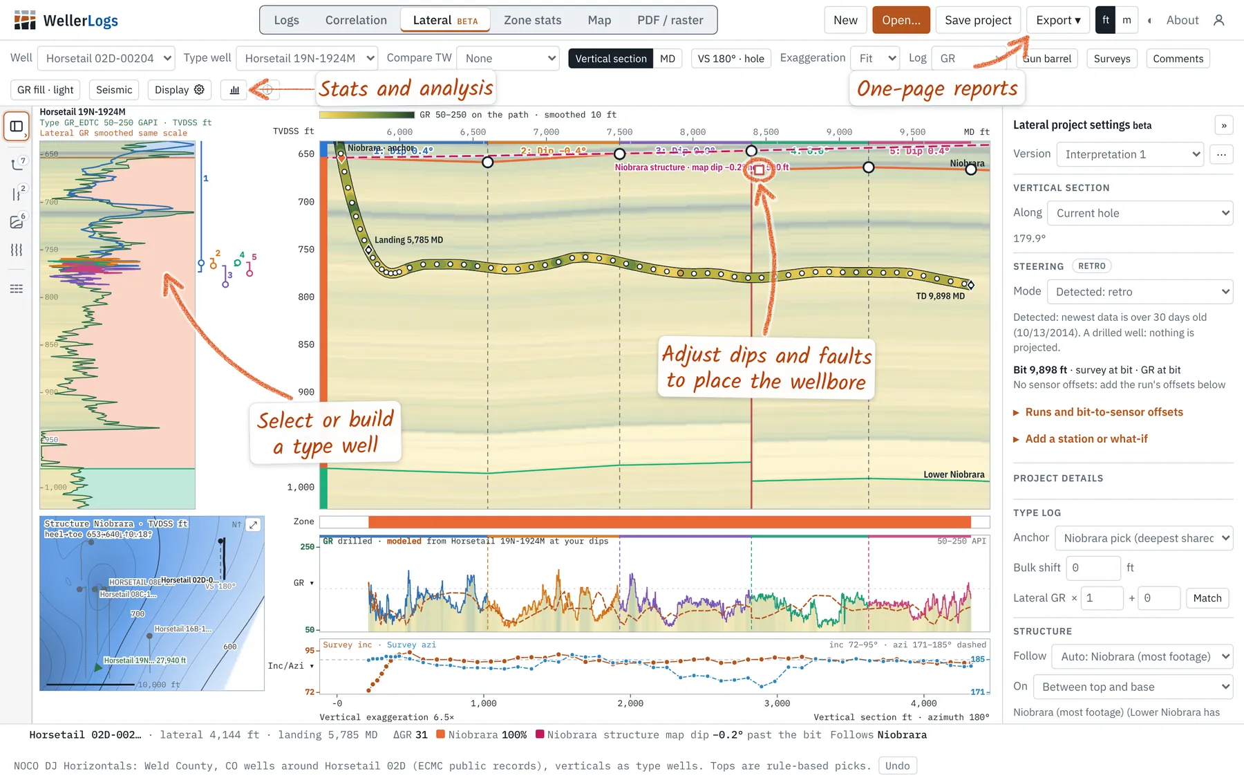
Retrosteering and lookbacks
Precise stratigraphic associations for analysis of drilling, completions, production and future planning.
- Type wells, dip segments, faults and thickness changes
- Several interpretations per well, compared side by side
- Time in zone and in target, by segment
- Undo, versions and saved projects
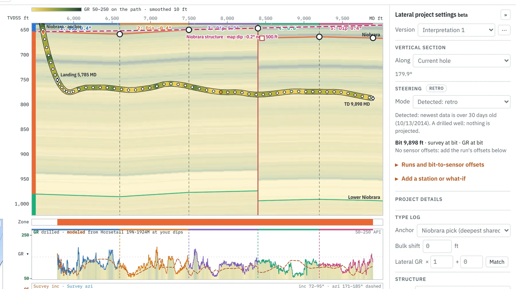
Field correlation
Tie each lateral to the verticals around it, and the field to its tops.
- Cross sections of verticals and laterals, flattened on any top
- Tops picked by dragging, or loaded from CSV and Excel
- Zone petrophysics: shale volume, porosity, water saturation, net pay
- PDF and TIFF mudlogs beside the digital logs
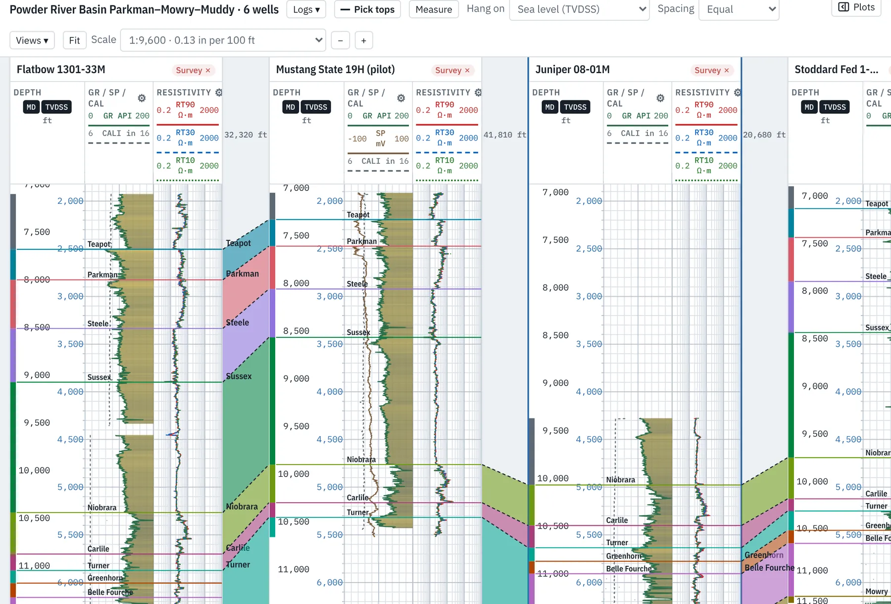
Subsurface mapping
Structure and isopach maps that update as wells are picked and interpreted.
- Grids from every well’s tops, contoured and posted
- Final interpretations add their tops along each lateral
- ZMAP+, CPS-3 and XYZ grids and lease polygons
- Snapshots to compare the prognosis with what was drilled
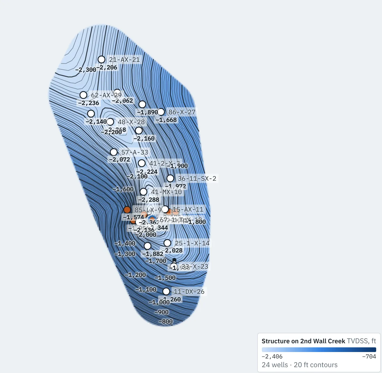
Well planning
Land the next well on what the last ones found.
- Directional plans, with every revision kept
- Landing depth from mapped structure
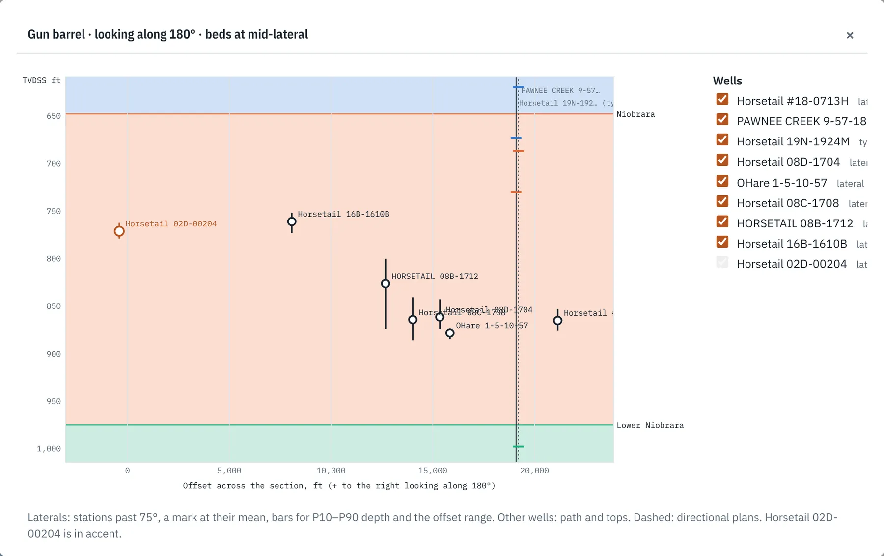
- Gun barrel spacing of offset laterals
- SEG-Y seismic behind the section
Reports and analysis
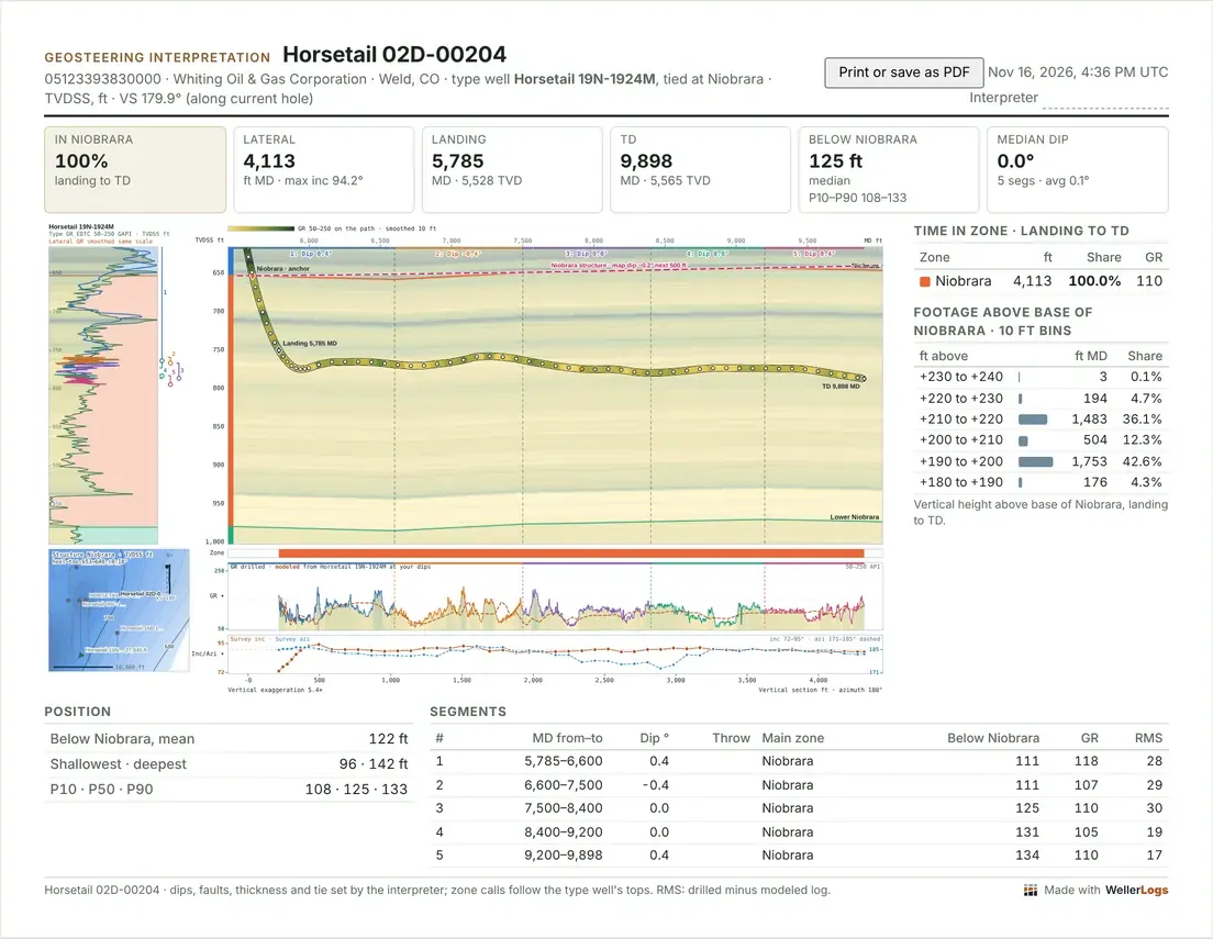
One-page geosteering reports, with your logo and your client’s.
- Time in zone, footage above the target base, segment table
- Footage, gamma ray and ROP by zone or segment, with crossplots
- Horizons and tops crossed as CSV, with latitude and longitude
- Print-ready pages and PNG images
Reliability
- Tested calculations, screens and results
- Nearly 300 automated checks on the math, the file readers and every screen before each release.
- Works without the network
- It runs on your computer, offline. No license server stands between you and a well.
- Your wells stay private
- Files are read on your computer. Nothing is uploaded on the free version.
- Multiple interpretations
- Manage and compare multiple interpretations, and plan what-if scenarios without disrupting another.
- Common, interoperable file types
- Projects use common formats: CSV, LAS, JSON, XML, XLSX, ZMAP+, SEG-Y and more, to integrate with other applications and workflows.
Compared with StarSteer and ZoneVu
| WellerLogs | WellerLogs Projects | WellerLogs Pro | ZoneVu | StarSteer | |
|---|---|---|---|---|---|
| Price | Free | ¢ | $ | $$$ | $$$$ |
| Workspace | Local browser | Local browser | Local browser | Browser | Browser + desktop |
| Data host | Local computer | Local computer + cloud | Local computer + cloud | Local + cloud | Local + cloud |
| 3D mapping | Export ready | Export ready | Yes | Yes | Yes |
| Team project sharing | Export to share | Limited team size | Unlimited | Yes | Yes |
| Completion analysis | Export ready | Export ready | In development | Yes | Yes |
| WITSML streaming | Retrosteer and segment adds | Retrosteer and segment adds | In development | Yes | Yes |
Run it beside ZoneVu or StarSteer if you already have one: horizons and tops move between packages as files.
StarSteer, Solo Cloud and ZoneVu are trademarks of ROGII and Ubiterra. Weller Logs is not affiliated with or endorsed by them. Their columns are our summary of public information as of November 2026, and the price marks are our estimate.
A Niobrara lateral loads as an example.Questions: talk to us.
Open the app