
Retrosteering & post-drill wellbore placement
Free your laterals.
Enhance your analysis with accurate wellbore placement.
Your first wells are free. Nothing to install, and your files stay on your computer.
Start
01
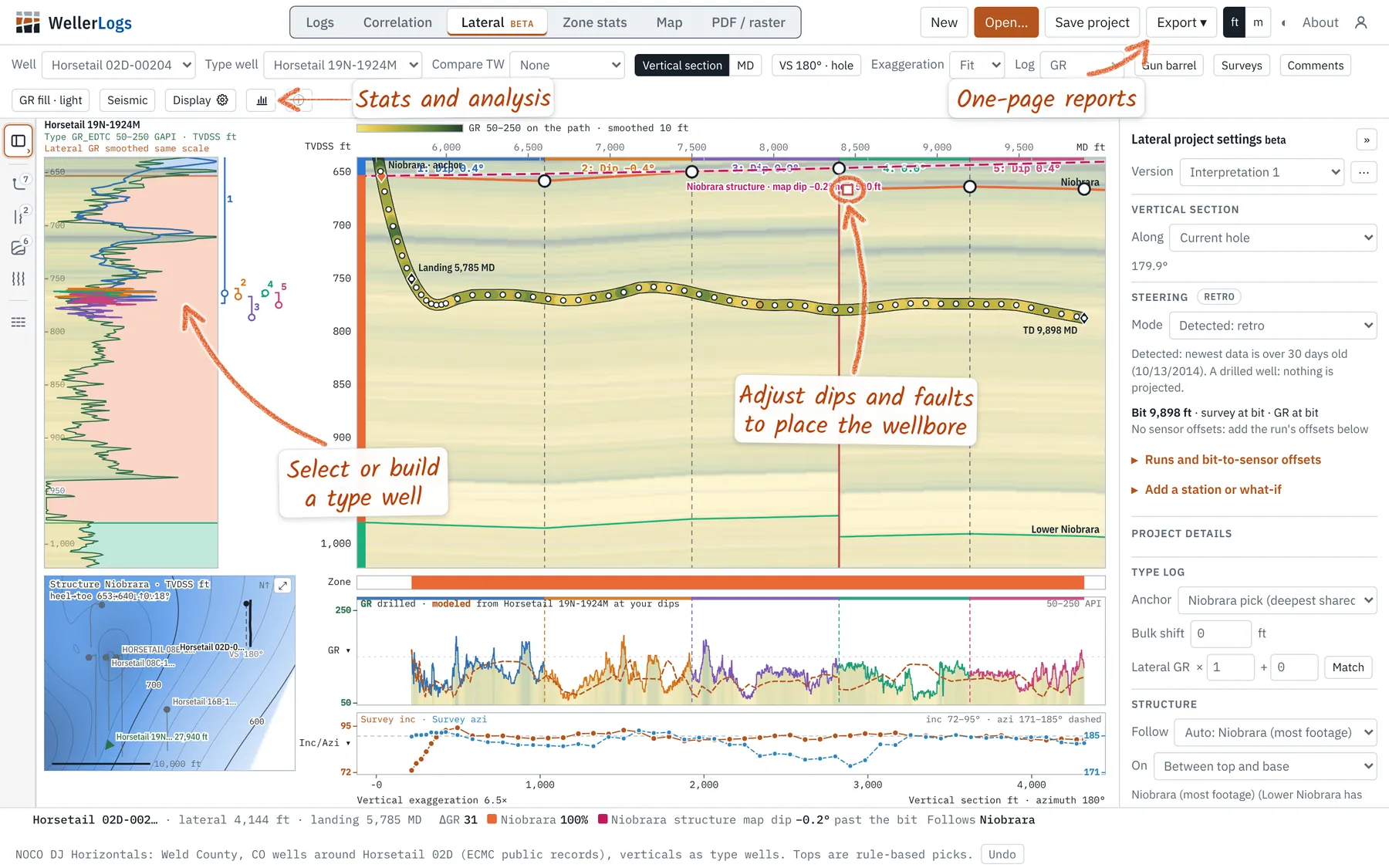
Open the lateralIts LAS and survey, and a vertical well for the type log.
02
Pick a type wellChoose the anchor top. The beds draw across the section.
03
Set the dipsMatch modeled gamma ray to drilled. Add a fault where a dip will not fit.
Lookbacks on drilled laterals
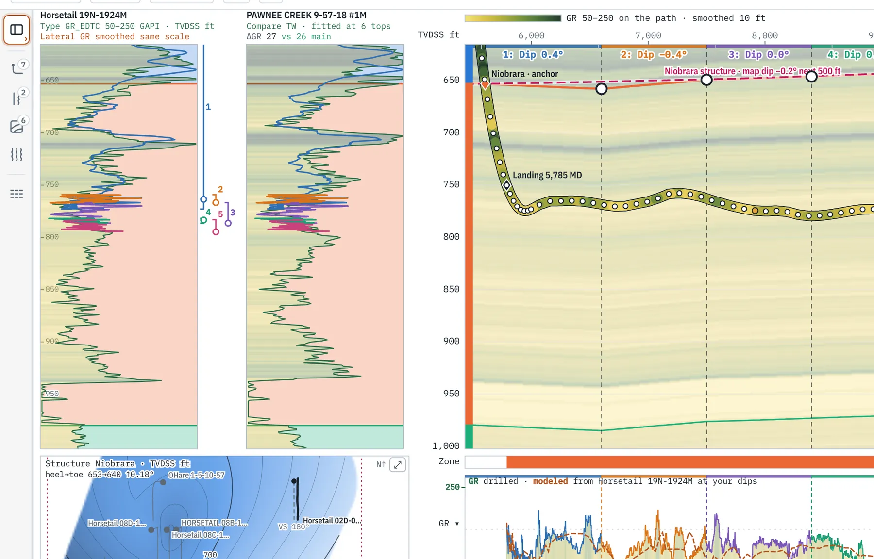
See where each lateral landed, foot by foot, against one type well or several.
- Two type wells side by side, with ΔGR for each
- Faults, and zones that thin or thicken along the hole
- Footage in zone and in target, by segment
- A version for every interpretation
Correlate the field
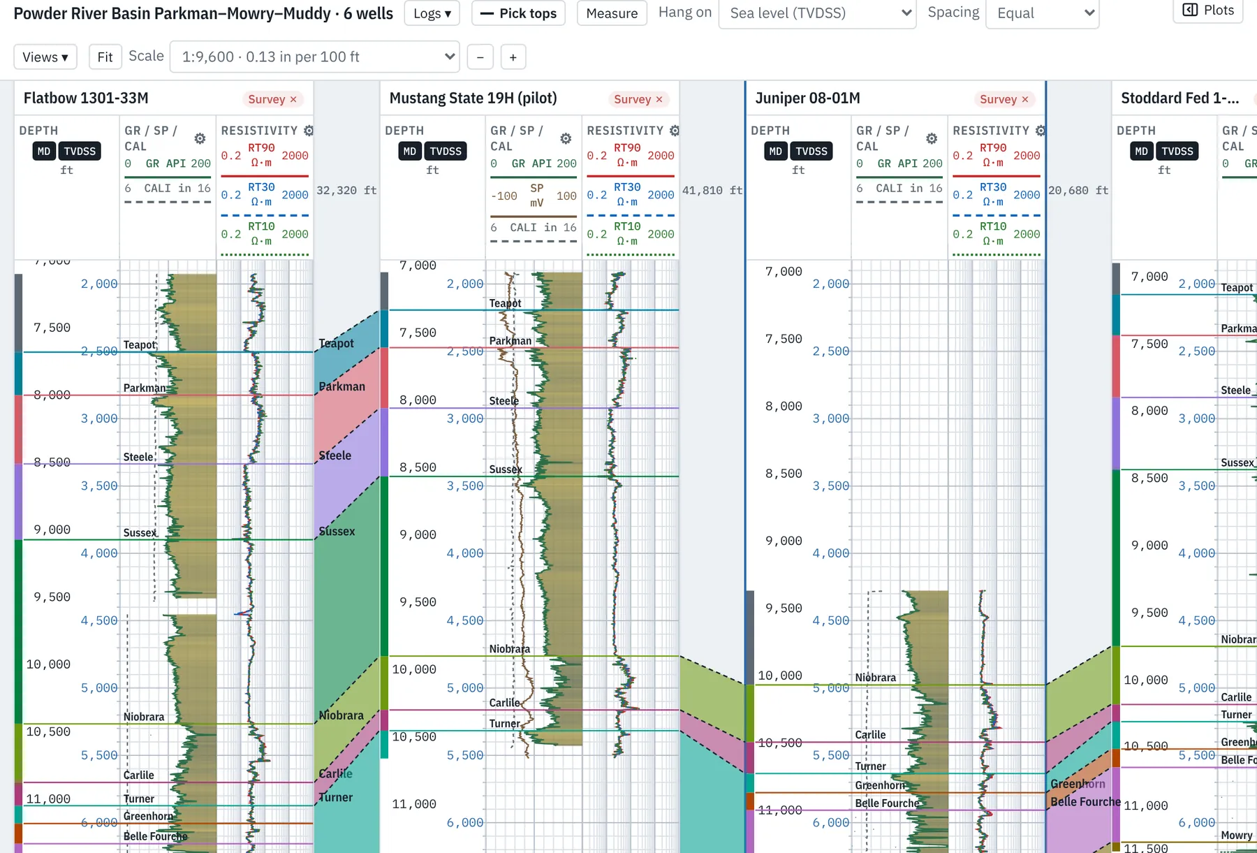
Hang verticals and laterals in one cross section and carry the tops across the field.
- Flatten on any top
- Drag to pick tops, or load them from a file
- Shale volume, porosity, water saturation and net pay by zone
- Structure and isopach grids from the picks
Stats behind every well
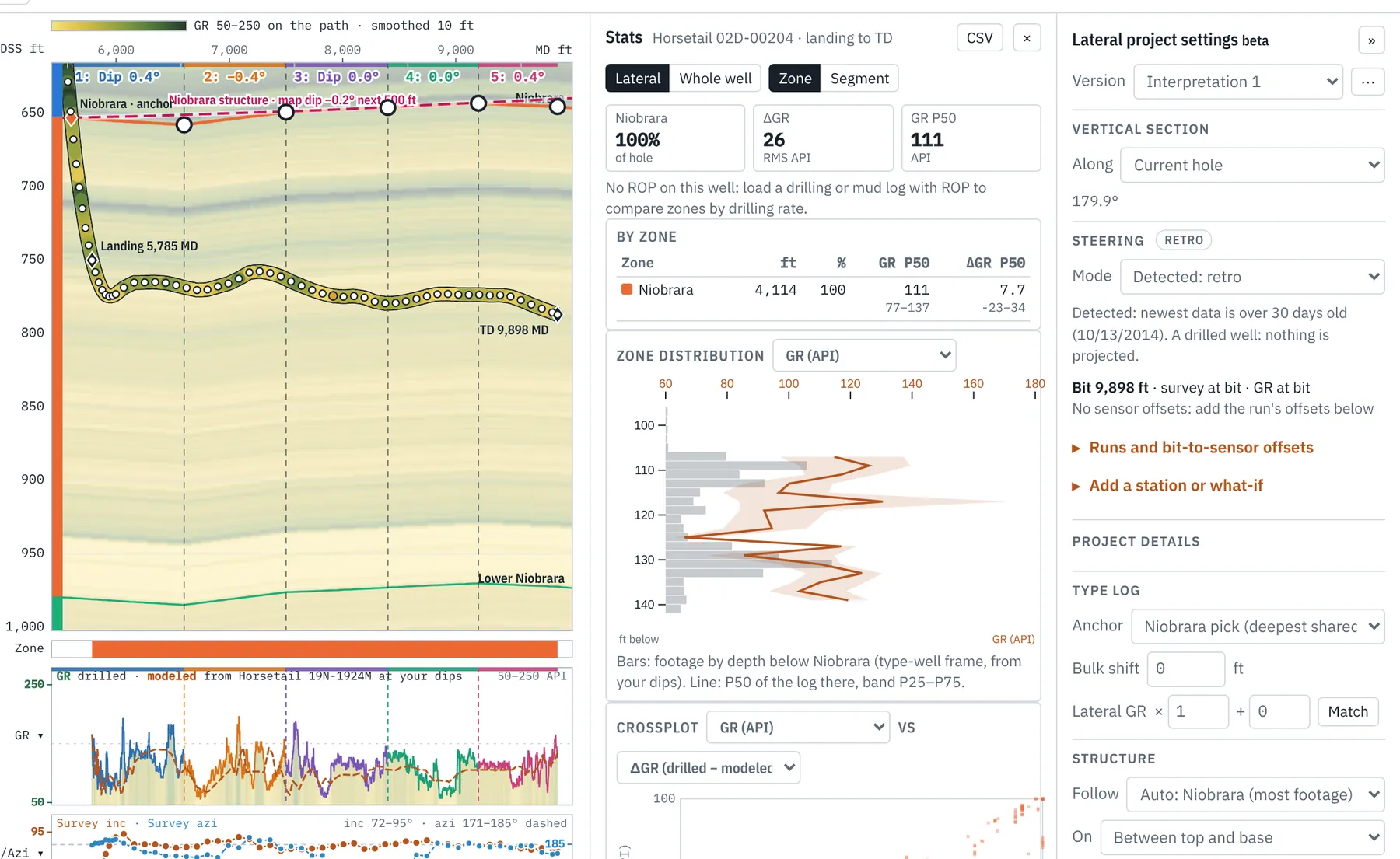
Tie gamma ray, ROP and footage to the zone the bit was in.
- By zone, by segment or by target window
- Crossplots of any two curves
- The logs that move with ROP
- Samples to CSV for your own analysis
Workflows
- Retrosteering and lookbacks
- Precise stratigraphic placement for reviews of drilling, completions, production and planning.
- Field correlation
- Cross sections of verticals and laterals, formation tops and zone petrophysics.
- Subsurface mapping
- Structure and isopach maps from every well’s tops and interpretations.
- Well planning
- Directional plans, landing targets and gun barrel spacing in one project.
- Operations geology
- Survey checks, comments at depth and one-page reports.
- Common file formats
- LAS, CSV, JSON, XML, XLSX, WITSML, ZMAP+ and SEG-Y, to work with the rest of your software.
Comparing packages? See Weller Logs beside StarSteer and ZoneVu. Every tool is in the geosteering guide. We also take geosteering and operations geology work.
A Niobrara lateral loads as an example.Your own files work the same way.
Open the app